BASIS
The BASIS module is the backbone for the use of other windPRO modules and gives access to an user-friendly graphical user interface for designing wind farm projects.
-
Project Management
A tool for the effective administration of your projects with full overview of the projects on the Project Explorer globe -
Turbine Catalogue
The most comprehensive wind turbine catalogue in the world with technical data on more than 1,000 different types of WTGs -
Map Management System
Easily design your project layouts on top of online maps offered by EMD or other providers -
Data Handling Tools
Trim and adjust large amounts of data, view terrain profile, import/export shape files and more -
Online Data Services
Access global elevation and roughness data from different sources, satellite images and turbine locations.

Project Management
All necessary background information for establishing wind farm projects such as turbine data, height contours, roughness, maps and satellite images are accessible from BASIS making it extremely easy to setup wind farm projects anywhere in the world.
All entered project information is stored in objects which are placed on the map(s). Objects can be organized in a layer structure, which makes it easy to work with multiple layout options and background source data.
BASIS interfaces with other GIS systems through exchange of common file formats such as shape, dxf, xyz, kmz files etc. It is possible to present calculation results directly on the map as part of the work space.
BASIS includes synchronized display with Google Earth allowing you to present your wind farm project with photo-realistic turbines and enabling the use of Google Earth for precise geo-referencing of houses or other objects.
Effectively administrate your projects with full overview of the projects on the Project Explorer globe.
When establishing a new project, the Wizard tool can be used to download available online data from the windPRO Online Data Services at the site location. All data is organized in dedicated working layers, ready to be used for your further analysis and calculations.

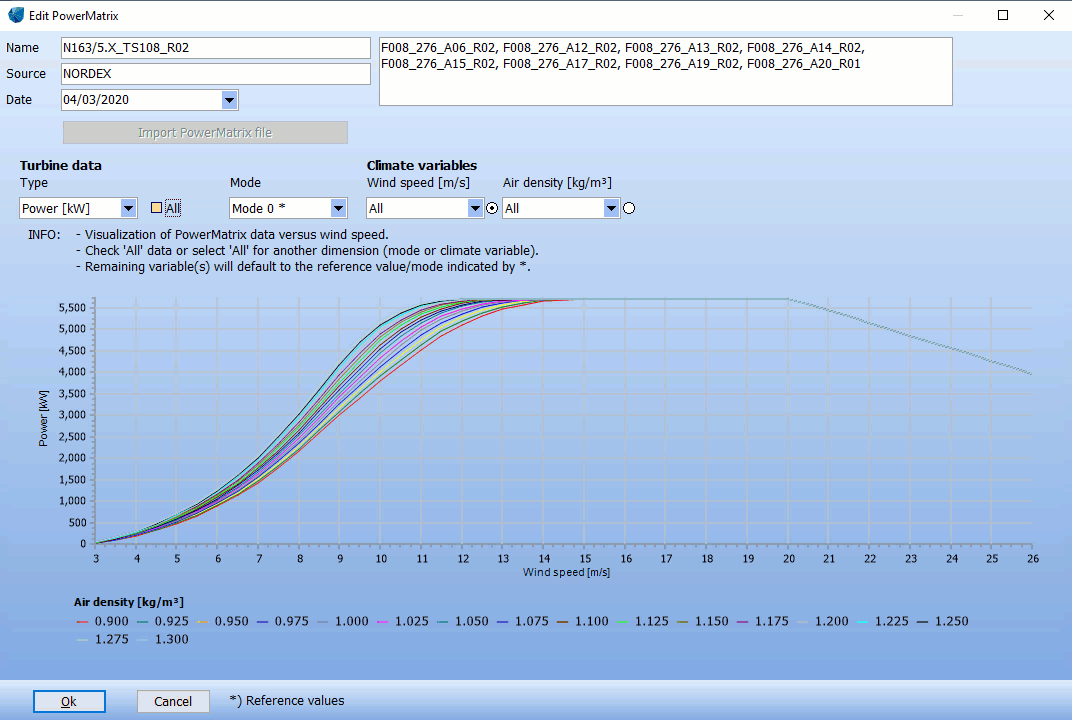
Wind Turbine Catalogue
The windPRO WTG catalogue is the most comprehensive wind turbine catalogue in the world with technical data on more than 1,000 different types of WTGs, constantly updated with data received directly from the manufacturers. The WTG catalogue can also be supplemented with your own turbine definitions.
The WTG Catalogue includes the following datasets for each turbine:
- General Data identifying the wind turbine, i.e. manufacturer, type, generator size, rotor diameter, hub heights, tower type, blade width and photo of the WTG.
- Power Curve (multiple datasets possible) including information on origin of data and thrust curve
- Noise Data (multiple datasets possible), including octave/third octave data (if available), data at hub height or at 10m height, origin of measurements
- Visualization Data (multiple datasets possible), i.e. geometry and the colours of the wind turbine
- eGrid Data, including the relevant electrical information of the turbine type
- The WTG Catalogue includes technical data for wind turbines currently offered by leading manufacturers as well as data for older wind turbines no longer produced. This allows the user to include the effects of operating turbines when preparing calculations for new nearby wind farms.

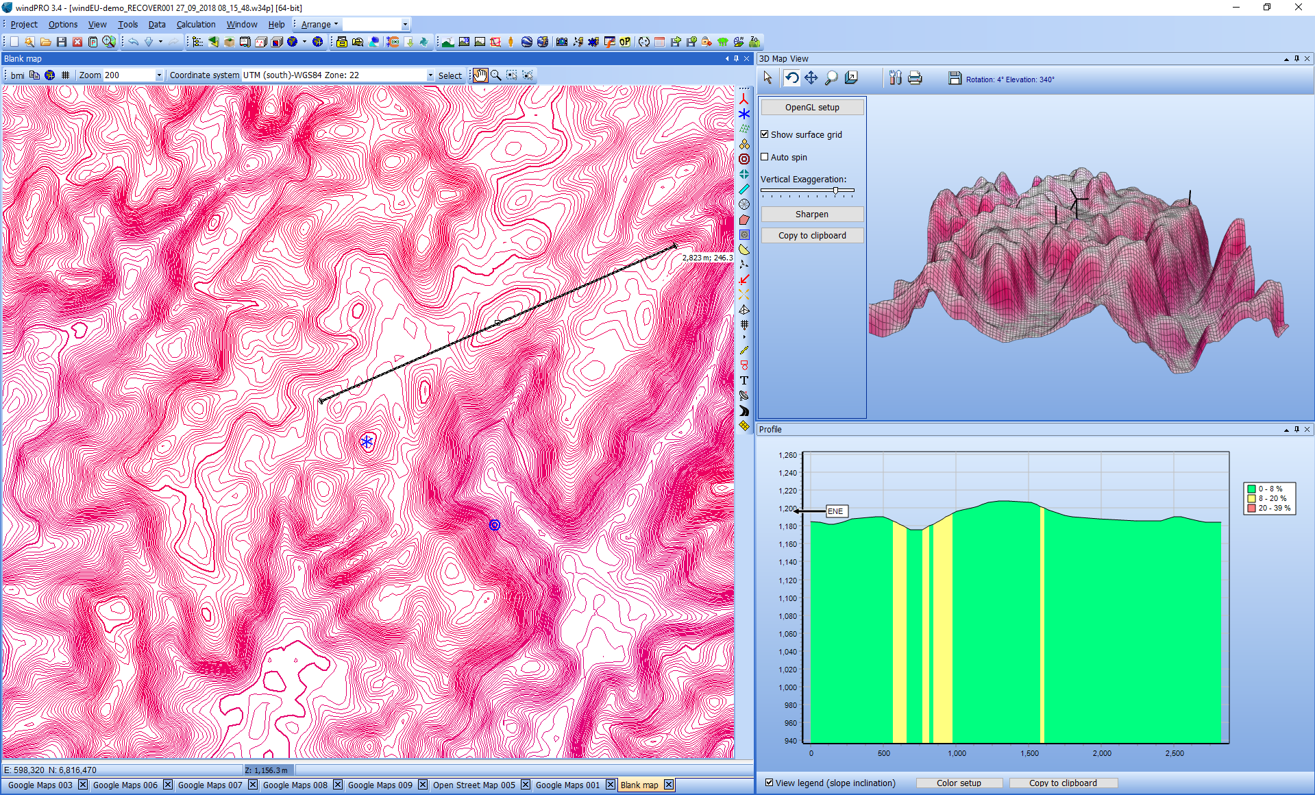
Map Management System
The Map Management System makes it easy to design your project layouts on top of online maps offered by EMD or other providers. Maps can be automatically downloaded while scanned maps can be imported and georeferenced by the user.
BASIS includes a massive database for all major coordinate systems and datums and supports also use of numerous country specific coordinate systems.

Data Handling Tools
BASIS includes special tools for many purposes such as trimming and adjusting large amounts of data; import/export of data e.g. shape files and GPS data; terrain profile presentation including WTGs and measurement masts; quick profile tool for checking site elevation data; map composer for creating maps for reports with specified resolution and with customizable legends.


Online Data Services
In BASIS you have access to Online Data Services with global elevation data (SRTM + other data sources), global roughness data from different sources, satellite images (worldwide) and other maps for use as background maps. WMS and TMS server maps and Google overlay maps are supported.